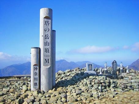
Mt. Tōno-dake (搭 ノ 岳)


Region: Kanto, Nigata Prefecture
Elevation: 1,490.9 m (4,891 ft)
Coordinates: 35°27′N 139°9′E
Mt. Tounodake (also known as Mount Tō / 搭 ノ 岳) is in the Tanzawa mountain range runs about 40 kilometers east-west through northwestern Kanagawa Prefecture. There are number of mountains in Tanzawa range and two are in the list of “100 Famous Japanese Mountains”. Both can be hiked in a same trail and Mt. Tonodake (Tohno-dake) is the highest peak.
From the Okura bus stop (also visitor center with parking lot), it is about 200-300M walk along the road to the trail head. I let the distance fooled me – I was physically and more importantly, mentally was not up to the steep and physically demanding climb waiting for me with less than couple of hundred meters.
Trail distance is short but consistently steep and physically demanding with occasional steep stairs with an elevation gain of about 300 – 400 meters. I faced the consequences along the hike for lack of preparedness and took unusual number of breaks - more than once thought of calling it a day.
About halfway (no – I did not measure), there is a hut with couple of benches with magnificent view. However, there is steep slope to reach the hut. It was painful – I treated myself with well-deserved ramen. If it wasn’t for the view, I probably lay there all day waiting for someone to carry me. After, I continued through the trail towards the peak – after about 500 meters, another set of wooden stairs, and the summit with spectacular 360-degree view of Tokyo, Yokohama, Enoshima and magnificent Fuji-san. I did it – wait I ran out of the water – talking about lack of preparedness eh! The good news is there is a shop – very unusual for mountains in Japan.
This is a very popular (open year-round) area for backpacking, camping, and hiking, and I’ve encountered many hikers along the way. Plenty of rest areas and couple of shops to buy food and drinks. Many seems to campout and if I am not mistaken, there is a hut at the peak where you can sleep overnight.
The trail follows the ridgeline and is nicely maintained. No rocky areas rocky areas so no truly hazardous sections. Take plenty of water – you are going to need it There are some lush green and wooded areas but generally is very open and spacy. Depending on fitness level it should take 4 - 5 hours. Start early as it start getting darker around 5.